
Akromaster
-
Posts
192 -
Joined
-
Last visited
-
Days Won
1
Content Type
Profiles
Forums
Gallery
Downloads
Blogs
Events
Store
Aircraft
Resources
Tutorials
Articles
Classifieds
Movies
Books
Community Map
Quizzes
Videos Directory
Everything posted by Akromaster
-
I think this landing does look quite wild but even with less wild landings the camera angle ‘exaggerates’ the lateral movement - like for example videos you often see of bullets as seen from the point of the shooter.
-
Looks legit to me. I’m no expert but to me the shadows, reflections and the lighting all look consistent...if it is a fake, he paid a lot of attention to the detail. When you watch a few of these videos, I think you’ll notice that the angle and distance the video is taken seems to exaggerate distance and curvature of the runways..I seem to recall a comment to that effect about such videos. Ak
-
Yea..awesome. Zip lock bag is probably a good thing to keep it in if we get one then.
-
Has anyone used the syringes you can find at auto part stores? They come in 200ml to 500ml usually and range from $30 to $80...pricy for what they are! They have a flexible tube at the end for hard to reach places which is exactly what we need...
-
Loved the movie but cgi for flight scenes could have been done better. My list of wrong things with these scenes: 1. Why were they flying at 2000ft. Is that historically correct for the Dunkirk event? As a fighter you'd want to be pretty high even if you were hunting low flying bombers. They were even lower than the bombers! Good way to get shot by climbing up to the bombers' rear guns. Did you notice too that one minute they were on the deck, the next they were in the clouds! 2. The formation was way too tight. Historically they flew close formations but not that close...in the movie they were almost wingtip to wingtip. 3. The Luftwaffe escorts on the deck with the bombers? I doubt that...they were told to stick with the bombers but that came later as a result of the losses during the BoB, which the pilots did not agree with. 4. The English pilot was a terrible shot during the dogfights at what looked like 100ft behind the me109s and the bombers. Then while his engine is dead he pulls off a miraculous shot to take out a high speed diving Stuka! 5. When the spitfire is gliding after his engine cuts out, his flaps are clearly lowered for landing and they only had one stage of flaps. At what looked like 1000ft off the deck, he manages to turn the plane in the opposite direction to take out the Stuka and glide out of range of his mates below. What did seem correct is the spitfire firing .303 guns...no cannon rounds which is correct for the earlier spitfires. There was even a scene where the 109 does a negative G dive and the spitfire coughs black smoke trying to follow due to the carby in use at the time. Other than the flying bits, I thought the movie was quite intense and a good watch.
-
Harvey Bay Flyin Seafood Festival Sunday 13th August
Akromaster replied to Graham Pukallus's topic in Trips/Events/Seats
There should be more events like this... -
Elon Musk to quit SpaceX, Tesla and Solar City
Akromaster replied to red750's topic in Aircraft General Discussion
His split from Amber is obviously bigger news. -
In the context I think we're discussing this, which is low altitude inadvertent spin, I would agree that most people wouldn't react correctly quick enough. It's a very short period of time to apply the correct response with not much height before something happens. For most of us, I would suspect just wouldn't respond [correctly] in time. It reminds me of a documentary I saw some time ago about firefighter training. They pitted an untrained host versus a firefighter to control a fire in a room and it was obvious that even with "some" training, the muscle memory from the drilled firefighter was well advance of the host. Like most things, unless you're doing it all the time (like a competition aerobatic pilot) your reaction time will never be optimal and so the emphasis on training to avoid it in the first place is the right one. This isn't the exact reference, but here's an article that talks about the firefighting repetition training: Why firefighter training depends on repetition
-
Caution? At least provide an argument for your caution. As others have said, knowing your position is 'obvious' but as a student, that's harder said than done. I recall in my training that it was a lot harder to pick out landmarks than I thought. Tracks that are marked like major roads was hard to spot, where there should be a river looks like a creek from the air, where there's a lake, is a dry bed, etc. It took me quite a while to get used to how things look from the air, especially if you haven't wondered out beyond 25nm. As far as I'm aware flying there's no law against using whatever resource you have access to, like google maps, to get familiar with the planned track. I still use it to plan for flights into airfields I haven't been to, like what my 10m landmarks look like.
-
Know where you...keep track of land marks and heading. Probably helps if you fly your planned track by google maps before hand.
-
Just before 40sec you almost timed the cymbals with the landings :)..not sure if it was intended but great effect.
-
The missus pointed out a missing force...'wifey'.
-
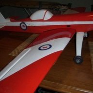
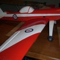
It looks bigger than a Cri-cri and just as big as a sd-minisport, Corby starlet or Hummel bird!
-
Thread drift, but just today I watched a dump truck tailgate a car for a significant period of time on the freeway then when he turned off, he was on me and when I turned off he was onto another. All this when there are free lanes on either side for him to over take if he so wished. Just dangerous behaviour if you ask me. <Just wanted to voice that coz it's my pet hate..back to regular channel>
-
Minor service - expected time & cost
Akromaster replied to Akromaster's topic in AUS/NZ General Discussion
I haven't but just looked him up and found his web site... wow, he's got an interesting list of articles there. Will have to have a dig through them. -
Minor service - expected time & cost
Akromaster replied to Akromaster's topic in AUS/NZ General Discussion
Yep...thanks Bruce. Working through the week makes that difficult unfortunately but yes I've read others do that here and seems a strange concept that must be fairly unique to this industry. I keep going back to it but I can't imagine my auto mechanic letting me into his workshop to help out. @pmccarthy, I'm a member of Bendigo flying club and know of Rod Shearer because they use him to service their tecnams. In fact I've been in contact with him about something else and may seek him out next time. -
Good locations in NSW for a day trip?
Akromaster replied to Pilot_DM's topic in AUS/NZ General Discussion
Never been but this looks interesting: toumbaal-plains -
Minor service - expected time & cost
Akromaster replied to Akromaster's topic in AUS/NZ General Discussion
I downloaded and had a quick look at it yesterday...although I don't plan to do it myself, I'll have a good look at it before the next service. -
Minor service - expected time & cost
Akromaster replied to Akromaster's topic in AUS/NZ General Discussion
Ok gotcha...and from what I've gathered on the forums that the 25hr oil change for Rotax is recommended if you use avgas so all good there. -
Minor service - expected time & cost
Akromaster replied to Akromaster's topic in AUS/NZ General Discussion
That does help! A couple different perspectives here. Changing plugs at 200hrs as suggested by Mick above seems high. It probably depends on the condition?? @Nightmare, what was involved in your 25hrs? Inspect and oil change only right? From discussion here, hopefully it's helped other new aircraft owners because it certainly open my eyes to what I should expect to get as part of my service. Might need to shop around a bit! -
Minor service - expected time & cost
Akromaster replied to Akromaster's topic in AUS/NZ General Discussion
Thanks Nightmare..that's the kind of perspective I'm looking for. -
Minor service - expected time & cost
Akromaster replied to Akromaster's topic in AUS/NZ General Discussion
Ok...and so as you would expect from your auto mechanic an inspection report should detail what was done. Do folks normally get a report as such? If not I wonder what an abbreviated form might look like. I can't imagine listing a hundred items on an inspection report unless a prepared list was used. Or is that what the Rotax checklist is? Again, my auto mechanic does not normally supply his inspection report as part of the invoice however he will state something like '20 point service inspection' and associate a cost to it. -
Minor service - expected time & cost
Akromaster replied to Akromaster's topic in AUS/NZ General Discussion
Thank you both. The answer I was after was along the lines of crashleys' response, however, Downunder you raise an interesting point. For exactly the same task why would you pay one person more to do it than the other just because of their title? It's not rocket science is it to change a spark plug? Economic costs such as the costs of the spark plug or business running costs may play into the pricing but in real terms, the task is the same so the price should not be vastly different. Anyway I digress...I just wanted to know when I'm being taken for a ride. That is the root of my question. And when you hear figures as crashley quotes compared to hours on hours, you'd think "hang on a minute? what do you take me for?" The only thing I have to compare to at the moment is how long my auto mechanic takes but he's got to move a lot more things to get to the oil and spark plugs than an L2. -
Just wondering what people are being changed for a Rotax minor service: * Oil and filter change * Spark plugs x 8 * Labour - how long do you expect this to take? 2 hours?
-
Yea..I was wondering that myself. When I first saw it, I thought it was too unbelievable that a plane that big could just gently fall onto he bridge and have almost no damage. In any case the shadows just didn't look right, like the bridge frame casting shadows onto the wing??


